About Warrumbungle Shire Council Community Directory
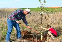
The Warrumbungle Community Directory provides a central resource for health services, agricultural support, sporting clubs, social groups and educational programs across this rural shire. It highlights local events, volunteer opportunities, community halls, libraries, emergency services and welfare organisations, helping residents connect with each other and access the services that support country living.
Info Hubs in the Warrumbungle Shire Council
They provide a central online platform where individuals can easily find local services, community programs, and events tailored to their needs.
Browse popular categories viewed in the Warrumbungle Shire Council Community Directory


Explore clubs, groups, and services in
the Warrumbungle Shire Council Community Directory
Showing 6 of 28 Categories
Find Local & Visiting Services in Warrumbungle Shire Council
The Warrumbungle community directory features categories such as health and wellbeing services, disability and ageing support, child care, community clubs and halls, education and employment programs, environment and conservation, arts and creative activities, and sport.
Listings also include Aboriginal services, legal and advocacy support, crisis and emergency services, accommodation, transport, volunteering and welfare assistance, as well as recreational and self‑help groups.
Many programs are run by local organisations and service clubs within the Warrumbungle, though some specialised health, disability or cultural services travel from nearby regional centres to support residents.
Warrumbungle Shire Region
Home to Australia’s first dark sky park, the Warrumbungle Shire is a haven for astronomers, bushwalkers and nature lovers. The jagged volcanic peaks of Warrumbungle National Park rise above woodlands, offering hikes to lookouts such as The Breadknife and Grand High Tops. Nearby Coonabarabran hosts the Siding Spring Observatory and the charming Crystal Kingdom museum. Locals often explore the Sandstone Caves walking track, with its ancient Indigenous rock art, and stop for fresh pastries at a beloved bakery in town.
Warrumbungle Shire Council has an approximate area of 12,000 km².
It is within the state electorate of Barwon.
Warrumbungle Shire Council Community Directory
The directory provides up-to-date information for community organisations who provide services in the Warrumbungle Shire Council area.
Find Local Events...

Warrumbungle Shire Council
Community Diary

Warrumbungle Shire Council
Give Local

Warrumbungle Shire Council
Community Info